Lots of walking stuff

Monday, 21 November 2011

Win Hill November 19th 2011

Parked up at Hatherdene car park Bamford, just before the junction with the A57.

This was about a perfect day for walking as you can get. Clear, cool, gentle breeze – excellent.

Walked south along the road to the end of the reservoir. The path then drops down at about 45% below the dam. Alternatively I could have taken the path along the dam wall. Followed the path down to Yorkshire Bridge, and then the climb up through the edge of the woods  (Parkin Clough)was relentlessly steep. On the second half of the walk (north of the snake) there was lots of mountain bikers….you wouldn’t find any bikes on the climb from Yorkshire bridge....unless they were being carried.
Once out of the woods there is a short climb to the summit. Given this is an average hill in terms of height (it would just qualify as a wainwright if it was in the Lakes) the views are stunning. To the South Hope Valley , Lose Hill , Mam Tor , the Ridge, Southwest - the Vale of Edale and the edge of Kinder. to the North, Ladybower , Derwent Edge and Bleaklow to the North West.....brilliant.
The path then follows the ridge and drops down following an old Roman Road through the woods to Haggwater Bridge. The path down to the bridge is very steep and rocky , and wet, so slow going.

Once over the Snake, another climb up to the ridge (open Hagg) running parallel to the road and next to the woods. Eventually the path leaves the edge of the woods to open land towards Crook Hill. I skirted Crook Hill towards the farm. The path from the farm then drops down to the Fairholmes road and then back to the A57 and the car park.

I’ll definitely be doing this one again – a perfect days walking.

About 9.5 miles OS OL1 Dark Peak
Crook Hill from the top of Win Hill

Tuesday, 8 November 2011

The Roaches - Luds Church November 5th 2011

Parked up on the car park / lay-by just below rockhall at the eastern end of the Roaches.

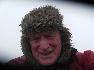
who is that geezer?


Luds Church - A Magical place
 For November , lovely mild weather, a little hazy but great walking conditions.
Picked up the path which ran for about a couple of hundred yards under the start where the rock climbers were starting up for the day and then the path led (very conveniently) up a staircase through a narrow gully up to the ridge.
West all the way to Roach end. This is a great gritstone edge and is as good as anything up in North Derbyshire straddling the Snake Pass. Views were fantastic on either side. Tittesworth reservoir and Leek to the South. Cheshire towards the south west. Staffordshire moors to the North. Brilliant. It was nice to find some water on the ridge (Doxey Pool) – you don’t find that on the North Derbyshire  gritstone edges.
At Roach end I took the path below Gradbach wood and found another concessionary path (not on map) up from there to the ridge and into the woods. There I picked up a muddy path through the woods to Lud’s Church. The gaiters I bought in Keswick did their job again and kept my feet dry despite a few ankle deep dips into the peaty mud.
I reached the bottom end of Luds Church after half a mile (or maybe less). I nearly missed it. There was a narrow opening covered by weeds and bramble which dropped down into what looked like a cave. Once I got past that first few narrow yards it opened out into a corridor maybe a few metres wide encased in two 20/ 30 foot cliffs. This is a magical place – if I had seen Gandalf and the fellowship coming round a corner I wouldn’t have been surprised. After a couple of hundred yards I emerged back into the woods.
From there follow the path back to the Roaches and back again along the edge to the car park. The walk I had printed from the web suggested taking the road after coming out of the woods – that would have been quicker but I didn’t want to miss a return trip along the roach’s edge.
Fantastic walk – definitely a repeat visit(s)

Hen Cloud - climb this next time


Forgot the camera so pics were from mobile phone.

About 8 miles OS OL24 White Peak

Sunday, 30 October 2011

Cromford 30th October 2011

This was similar to the walk I did a few weeks ago.  Parked at Cromford wharf and walked along the canal to High Peak junction. Staraight up the high Peak trail up to Black Rocks. I picked up one of the waymarked walks in the woods before I got to Black Rocks, and after a while this was closed off due to forestry works. Got lost for a bit looking for one of the other walks. Found the Green one which took me back to the top of the High Peak trail. Back down the hill and along the canal to the car.

Not very exciting but a decent walk when I only had a few hours to spare. I also put myself under a bit of pressure as I only had 2 hours on my parking ticket....quite a brisk walk to fit into two hours.

Pleased that the new gaiters I bought in Keswick did thier job and kept my boots and feet dry, as it was a wet start to the walk.


About 5 miles OS OL24 White Peak.

Dove Dale 29th October 2011

I have started working away for the next few months so don't want to be disappearing on all day expeditions on Saturday or Sunday. As a result I think the pattern up to the end of the year will be short 4 - 5 mile walks.

Anne still isn't 100% but convinced he to come on this one. Also on the basis that we wouldn't be going too far we also took Tammy. Start at dove Dale car park and simply walked along the bottom of the valley as far as the two caves before Mill Dale. Back again the same way and much to Tammy's consternation we crossed the river on the stepping sones with her on the end of the lead paddling across.

Scenery fantastic as usual, and despite her aches and pains Anne enjoyed it (particularly the caves).

About 5 miles OS OL 24

Sunday, 23 October 2011

Crich 22nd October

I only had Saturday afternoon spare, and this was a good one to do as I am only about 15 minutes drive from the start.
Clear , bright , cool autumnal day. Start - Amber Gate railway station just off the A6.
Couple of hundred yards along A6 (towards Cromford), and then up Chase Road to Cromford Canal. Along towpath (towards Cromford) to next bridge. Cross bridge and follow the waymarked path through Crich Chase. At the top edge of the woods turn right through a stile across two fields. Right on Chadwick Nick lane for about hundred yards and then take the path to the left across the fields to Crich. Great views SW / W across the derwent valley from here. Also Crich stand is visible to the North.
Path eventually ends in Crich , not far from the Market square. Left at the market square and then right to Coasthill which eventually end in a footpath. Follo this across two fields, and then right down the road with the entrance to the tramway village. Follow road around to Crich stand. More spectacular views across to Alfreton from here.
The footpath leads around the top of the quarry and drops down across the tram tracks. Path drops down past Wakebridge farm to road. Cross road and footpath continues just to the right. Follow path down through woods and past old quarry workings before reaching Cromford Canal.
Two miles back along the towpath to the start.

Great walk for a Saturday afternoon in Autumn.


About 6.5 Miles . OS OL 24 White Peak.

Monday, 10 October 2011

Castle Crag October 9th 2011

I had to drive home today so this walk fit the bill for 2 – 3 hours before setting off.

I walked out from Rosthwaite and took the footpath up the South Eastern side of the fell. Everything written about this fell is true. It is unique and even though it is less than 1000 feet the views across Derwent Water are fantastic.

I dropped down to the Western side and then did the valley walk around the foot of the Fell, around Low How wood and then back to Rosthwaite along the banks of the river Derwent.

A very enjoyable walk to end the weekend.

About 4 – 5 miles OS OL4


Skiddaw October 8th 2011

Being a walker of conscience I didn’t drive to the car park on the top Northern edge of Latrigg, but left the car in Keswick.

So out of Keswick via
Spooney Green Lane
and the tourist path up to Skiddaw. Given that my joints were aching from yesterdays walk and it was misty and it was p******* it down this was quite a brutal slog. Unfortunately no views to enjoy, and then once on the summit plateau absolutely battered by the North wind. So all I was left with was soaking wet feet (my fault I think – gaiters shouldn’t have been over the waterproofs), aching legs and more positively  a sense of achievement .
I had planned to do Skiddaw little man and Lonscale fell but decided not to in the foul weather.

I did detour of to the summit of latrigg on the way down, and again due to the mist , no views.

About 11miles OS OL4 North Western Area
I was on the summit for at least 45 seconds !!

Dale Head - Hindscarth - Robinson October 7th 2011

Long awaited trip to the Lakes. Anne has kindly given me a weekend pass for this.

I got up at stupid O clock and was in the Keswick area just after . By 8.30 I was parked up at the Slate mines car park on Honnister pass.

I was the only person there at that time and it was cold and misty. I have to say driving back to Keswick for a coffee and booking a lake cruise did cross my mind.

However, I set forth up the path over the road up to Dale Head summit. The path follows a fence for a lot of the climb. At the point the fence ended I marked a waypoint on my GPS….just in case.  Soon I was at the top…a great feeling – my first solo Lake District Mountain. However, Alfred Wainwright wasn’t impressed with me

 “Indeed if a car be used to the top of that pass, a man of conscience must feel he is cheating the mountain”

Hmmm – my legs certainly felt they had been engaged in some vigorous exercise by the time I got to the summit… 1300 feet in 1.25 miles is a fair old rate.

On the walk along Hindscarth edge I was treated to some great views in the gaps in the mist. The walk to Hindscarth was quite easy as there wasn’t much elevation involved from Dale Head. The view down the Newlands Valley was spectacular – we did that walk a few years ago – Little Town – Maiden Moor  - High Spy – Dale Head tarn and then back down the valley.

Hindscarth to Robinson was a different proposition. The joining path between the two mountains – Littledale edge dips down and up quite a bit. Once I got to the bottom of the dip I found the walk up to Robinson quite strenuous – about a 200 foot climb.
I sat at the top of Robinson for a while and enjoyed the views down to Buttermere, and South to glimpses through the clouds  of some of the big peaks.

There wasn’t an obvious round walk back to the Slate mines , so I retraced my outward journey – missing out Hindscarth. Although it was the same route it felt different as all the ups and downs were reversed.

Looking back at the Slate Mine on the ascent to Dale Head
Newlands Valley from the top of Dale Head

Dale Head Summit

Newlands Valley


View of Buttermere with Crummock Water in the distance from Robinson

Hindscarth

Littledale Edge between Hindscarth and Robinson

Top of Robinson


Predictably on the descent from Dale Head I lost the path and my GPS came into its own navigating me back to the top of the fence to rejoin the path.

Not an epic , but I was well pleased with my first solo Lakes  effort

Around 11 miles OS OL4 North Western Area

Tuesday, 4 October 2011

Bleaklow 2nd October 2011

Sunday afternoon after a taxi run to Manchester.

Parked up at Snake summit and walked the Pennine Way up to Bleaklow Head. The weather was  cloudy  with a bit of rain. I could imagine in poor weather this would be a grim place. The peat groughs along the path looked pretty soggy, so I stuck to the path. Onceat the summit there is a large cairn with a pole in the middle. However, you don;t have to wander far from this before it is out of site - an easy place to get lost.


Great view of the northern edge of Kinder filling the horizon - I was walking the full length of that a couple of months ago

I would like to come back here for a full day and allow some time to have a look for the Superfortress wreck.

About 5 miles OS OL1 Dark peak

Stannage Edge October 1st 2011

Apparently the hottest October day on record. A glorious way to spend a Saturday morning. I parked on a layby on Ringinlow Road just above Hathersage. Climbed the small hill opposite (Higger Tor) to enjoy the view before starting.

From Higger Tor, back across the road, and onto a footpath across to a car park at the foot of Stannage Edge. Then simply all the way along the edge to High Neb. As the weather and the views were so fantastic, I just did the return by the same way.
The only blot on the lanscape was a convoy of 4x4s driving along the edge on the return leg.
New boots and socks………luxury!!!
Around 6 miles OS OL1 Dark Peak

Monday, 19 September 2011

Patterdale 16th , 17th , 18th September

Booked a B&B for me and Anne at Patterdale for the weekend.

I haven’t been to Patterdale before and I have to say the scenery is awesome.

I had this idea that we could tackle Helvellyn via Striding Edge on the Saturday. However, given the fact that Anne hasn’t been well and hasn’t done any walking for a while it was a ridiculous proposition. As it transpired the weather was foul on Saturday (all morning) so it would have been plain daft to try. So by the end of the weekend I had managed three short walks (only around 3 miles). One with Anne and two on my own.

Walk 1 – Arnison Crag.

This small fell is close to the B&B (Home Farm) so on Friday evening (just before 6) I set off and a very slow pace as I kept stopping to admire the views and looking at the map to try and identify the surrounding hills. After a while I came to the wall that climbs up the fell and then just near the top there is a bit of a scramble away from the path to get to the summit. Fabulous views of Ullswater from here as the weather had cleared a bit.
This was a tidy little climb and got me in a sweat, and I realised that Anne would not have been able to do this one, so Helvellyn was a silly idea.

The path was waterlogged in places so my walking shoes got  soaked – I need some decent winter kit I think.

My legendary map reading skills came to the fore again, as at this point I thought I had climbed Birks (The path up to Birks is parallel with the wall for a while) After coming down I tried a short cut back to Home farm but this went wrong as I wasn’t on the path I thought I was. Got back after about two hours.

Only about three miles as I kept stopping to admire awe inspiring scenery. Very enjoyable and at least one baby Wainwright to claim…by co-incidence walk number 1 in book number 1!

Walk 2 – Aira Force

We spent the morning on an Ullswater cruise to stay out of the heavy rain. This was a very enjoyable two hours. Luckily as the boat was coming in the rain stopped and the sun started poking through the clouds. So a short drive to the Aira Force National Trus car park and a fantastic walk up the river to admire the falls and then back down on the other side. This was easily as impressive as the Ingleton water falls walk we did a couple of year ago.

About three miles.

Walk 3 – Grisedale Beck

I had a bit of time on Saturday evening before we went for dinner. Anne had a rest and I set of from Home Farm down the footpath along Grisdale Beck. I walked as far as the bridge over the Beck which starts the Helvellyn route and then I took the footpath of to the right (as I was heading back to Patterdale) so I wouldn’t have to go back the same route. Incredibly I gave some walkers accurate directions – they weren’t sure if they were on the right path to Patterdale.
From this path I met the one which climbs up to Birks. (The one I thought I had been on , on Friday). Taking the left fork here I headed back for Home farm crossing Hag Beck at some stepping stones (these were nearly covered after all the rain ). Across the bottom of Arnison Crag and back in time t set of for dinner.

Another short 3 miles.

This was a fantastic weekend even with the heavy rain – I will definitely be back to do that Helvellyn walk.


OS OL5 – North eastern Area

Cromford September 11th 2011

Slightly longer walk than the last one. Parked at Cromford wharf and then walked up to the high peak trail. From there up to Black rock and then the blue route around Black Rocks. Found some ripe blackberries up there and just had to stop for a few minutes to fill my face.

Blue route back down to high peak trail – down to high Peak Junction and back along the canal to the car.

About 5 Miles OS OL24 White Peak

Sunday, 4 September 2011

Dovedale 3rd September 2011

Perfect day for a walk – dry , slightly overcast with the sun breaking through every now and then.

Starting from Dovedale car park walked up the dale to the turn off to the left to Stanshope. Steady climb up Hall Dale to Stanshop.e I had worked up a fair old sweat by then so off came one layer of clothing. The footpath from Stanshope to Alstonefield crosses the top of Mill Dale , so once across the road there was a tidy climb up Harry’s Bank. In Alstonefield I couldn’t find the footpath I was looking for so walked a few hundred yards out of the village on the road and then took the first footpath on the left which took me to Narrowdale. My navigation went a bit pear shaped at this point. The path took me along the side of Narrowdale hill and there should have been a right hand fork leading down towards the start of Wolfescote Dale. Instead I ended up at a derelict farm (Field House Farm). The footpath off to the left fizzled out after a few hundred yards, so I spent the next twenty minutes or so tramping across farm fields looking for it. Eventually a couple of walkers helped me out and at that point I was only about a hundred yards to the start of Wolfescote dale.

The rest of the walk was all the way down the River Dove back to Dovedale – Wolfescote Dale - Mill Dale – Dovedale. Spectacular and beautiful scenery. Given that it only takes half an hour to drive to Dovedale I should be coming out here more often.

About 13 miles OS OL24


Hall Dale


Cave between Mill  Dale and Dovedale


Wolfscote Dale


Tuesday, 30 August 2011

Cromford 28th August

I wanted to find a walk which isn’t to far to drive to the start, with some uphill and good views. This definitely fits the bill. It only took me 20 minutes to get to Cromford Wharf car park. So just a short 4 mile walk. Over the A6 to Cromford Market place. Around the mill pond and then about 100 yards on the main road. Left onto
Bedhouse Lane
just past the Bell Inn and then follow the footpath up towards Black Rock.  The walk I was following (AA 1000 walks in the UK) suggested I took the right path at a fork in the footpath, but this just seemed to take me to the front drive of a house in front of the woods. I took the left hand fork and this took me through the woods and out at the High Peak trail below Black Rocks. I just followed the high peak trail back down to high peak junction and then back to the car park via the canal. I can see a couple of ways of adding a few more miles to this to make it a more substantial walk. The nice thing about this is that I could do this on a summer evening after work.


4 miles OL 24 White Peak

Curbar Edge Froggat Edge Aug 26th 2011


Another walk on Curbar Edge (with Richard F)

Starting from Curbar Gap again.  Baslow edge , Wellington’s Monument, White Edge, Grouse inn, Froggat edge , Curbar edge and back to Curbar gap.

Despite getting soaked for the second half of the walk this was quite an easy walk as there was no climbing involved. Great views all the way around.

I think this would be a great place to bring young kids for a picnic. You don’t have to walk too far from the car park and there are loads of places to sit and enjoy the view.

My supposedly waterproof jacket didn’t keep me dry in the downpour so it was useful to know that I need to do something about this before winter.

8 miles OL24 White Peak

Sunday, 21 August 2011

20th August 2011 Curbar Edge

First time I have done this walk.

Parked up at lay by just below Curbar Gap car park.

Plan A was to follow a walk from a book which was to drop down to the Derwent valley at Curbar. This changed to Plan B after chatting to a couple who were just setting off on a walk.

So Plan B was a walk along Baslow edge for about 3/4 mile and then take the footpath which drops down into Baslow. Over the bridge near the church and then pick up the footpath by the Derwent.

It took me a while finding the correct footpath near Bubnell farm.From there I followed the path down to Calver, over the road and then along the path past Stocking farm. Just after the wier the path crosses a road (New Bridge I think). The path drops down to the river but after a few hundred yards took me to a road (Sheffield / Froggat Road) - I backtracked (half way back to Calver in the end) but couldn't figure out which the correct footpath was to take along the valley to Grindleford.


So Plan C - I decided to pick up the footpath from Froggat up to the Edge. After a tidy climb I reached the point on the edge where Curbar Edge becomes Froggat Edge. Stopped for lunch here. I can't think of anywhere better to have lunch than sat on a gritstone edge in Derbyshire on a warm dry day - brilliant !!


Back along Curbar Edge enjoying the fantastic views across the Derwent Valley to the gap and back down to the car.

I'll definitely do this walk again - figure out the footpath to Grindleford and then do the entire length of Froggat Edge and Curbar Edge


OL 24 White Peak. About 7 miles (includes missed footpaths !!)

Tuesday, 16 August 2011

Saturday 13th August Shipley Park

Going away for most of the weekend, so decided on a short local walk before we set off.

Me and our ageing border colly Tammy.

Out of Smalley Village to Old Pit Lane and then across the fields to Shipley Country Park. It is quite a flat walk but there is some elavation as you approach the park - nice views across the park , and unfortunately the opencast workings to the right.


 Into the park, past the visitors centre and then back
out along Bell Lane. Before reacing Smalley Dam ,
 cut across the fields back into Smalley.


Only about four miles , but a nice start to the weekend. It was good to not have to drive anywhere and no map needed.  Tammy enjoyed it although she was limping a bit towards the end.

Tuesday, 9 August 2011

Sunday 7th August - Kinder Scout again

I was planning a solo walk along Curbar / Froggat edge, but got an invite up to Edale from a friend (Trevor). So with various family members that made a group of six.

We went up via the Nab , and Ringing Roger, and then did the edge path round to Grindsbrook, Crowden Tower, Woolpacks,and down via Jacobs ladder.

Compared to last week this was like a walk in the park.

Jake and Rowan didn't bring any waterproofs and sure enough were soaked when we had a downpour!! However, after the rain cleared and the wind picked up for a while they soon dried off. We stopped for lunch just below Crowden Tower, and found a piece of metal which could be a bit of aircraft wreck. I took a pic and put it back where we found it.

There were three guys with a dog who tried to climb down the gully near Crowden Tower - the poor dog didn't seem that keen. I have never tried that - it looks pretty steep. Sure enough they returned five minutes later looking for another way down.

Another great walk on Kinder, and a nice change for me doing it in a group.


Piece of aircraft wreck ?

About 8 miles . OS1 - Dark Peak map

Saturday, 6 August 2011

Sunday 31st July 2011 - Kinder Scout The Edge

For some reason I decided it would be a good idea to walk the entire rim of Kinder Scout. From Edale this is approx imately 20 miles. Bloody hell !! - My ageing frame is used to 6-9 mile walks so this one was quite a challenge for me.

Starting point Edale Car park. Up to the edge via the Nab. I did the short scramble to the top of Ringing Roger and then started anti-clockwise.  Great views from here across to Mam Tor and the Great Ridge. Keeping to the path I reached the Easternmost point of the walk Crookstone Knoll with a nice view of Ladybower Resevoir, and Derwent Edge.

From here turn west and start along the Northern Edge. This was the bit I was looking forward to as I have never done this section of Kinder before. Fairly soon after leaving Crookstone I lost the path. There was a path leading up to Mad Woman's Stones , but not the direction I needed. I kept heading in the right direction, but it was hard going in the heather. Eventually after about 20 minutes I found the path. The Northen edge has some faboulous views across to the North - Bleaklow , Featherbed Moss , Ashop Moor - see pics below. Seal Stones next , then Fairbrook Naize. At Fairbrook Naize I had to walk in towards the plareau along the edge of the gulley until it became shallow enough to scramble across to the other side. The views North East and West from here are magnificent. After five hours since the start I stopped for some lunch on Ashop Moor  Edge. At this point I was probably half way around. It seemed like slow progress but the views are so stunning I had to keep stopping to take pictures.

Keeping west the path finally meets the Pennine Way and then turns South East towards Kinder Downfall. More brilliant views down to Hayfield and Kinder Resevoir. Stopped at Kinder Downfall for some fruit. What is it about the sheep around there - they are not like normal sheep - cheeky buggers come up close and try to nick your food. - one was trying to nuzzle it way into my rucksack !!.

My legs and back were starting to complain by now , so the last couple of sections were a bit more endurance than a nice yomp along the edge. So along the western edge to the trig point at Kinder Low - turn East towards Pym chair and the Woolpacks, and then along to the top of Grindsbrook and the last leg back to Ringing Roger, and back down the same way via the Nab.

Now my aches and pains have subsided the walk is now a pleasant memory and an achievment, but if I am honest I would say (given my fitness levels) it was a few miles too far for enjoyment.

The whole thing took me 10 hours.


Fairbrook Naize

Northern Edge


One of the many wierd rock formations on the Ashop Moor edge

19 / 20 miles OS1 - Dark Peak map.

Big Moor 24th October 2024

 I have done the Curbar Edge / Baslow Edge /  Birchen Edge so many times it was good to try a different route in the area. This first time o...