This was a trip to mop up some of the western wainwrights still outstanding. I didn't bring Meg this time due to the distance and heat. Base camp was the NT campsite at Wasdale.
Day 1 - Wednesday 19 June Kirk Fell.
By the time I had arrived and set up camp it was two o clock before starting this 'there and back' walk.
There was about a mile of easy walking on the valley floor before the climbing began. all the time there are magnificent views all around in this walking Mecca.
 |
| Sca Fell |
 |
| The route up to Beck Head |
 |
| Footbridge before the start of the walk |
 |
| Great Napes on the edge of Great Gable |
The route up was fairly straightforward , up the valley to Beck Head , and then up onto the fell via rib end.
 |
| Wast Water |
 |
| Beck Head |
 |
| Scafell Pike summit on max zoom from Kirk Fell |
 |
| Kirk Fell Summit #200 |
 |
| The magnificent Great Gable |
 |
| Kirk Fell Tarn with the North top in the background |
A magnificent and satisfying start to the trip.
OS OL6 about 7 miles.
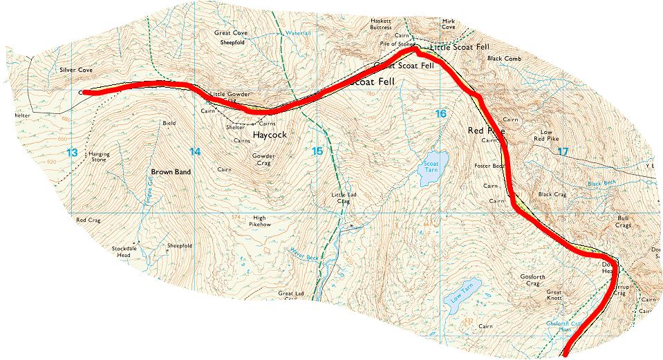
Day 2 Thursday 20th June Haycock and Kirk Fell
Another 'there and back' walk although with hindsight I could have made the return via NetherBeck valley.
To save a couple of miles of road walking at the start and end of the walk I parked at Overbeck Bridge.
 |
| Kirk Fell and Great Gable from Dore Head |
 |
| Stirrup Cragat the edge of Yewbarrow |
 |
| Looking down from Dore Head |
This route took in Red Pike, so this time I didn't wander past the summit without visiting it.
 |
| Red Pike Summit |
 |
| Red Pike Summit |
Apart from a shower followed by some low lying cloud around the time I got to Scoat fell the navigation was fairly straightforward using the wall between Scoat Fell and Haycock as a guide.
 |
| Caw Fell Summit |
 |
| Little Gowder Crag from Caw Fell |
 |
| Haycock Summit |
 |
| Haycock wind shelter |
 |
| Great Gable in the distance |
I thought Little Gowder Crag was Caw fell until I couldn't find a cairn. However, from the top of this crag I got a magnificent view of two RAF jets flying past at eye level and then diving down to fly over Ennerdale water.
Great to touch the top of Red Pike. Wainwrights #201 and #202. OS OL 6. about 13 miles.
Day 3 Friday 21st June 2019. Buckbarrow, Seatallan and Middle Pike.
I was feeling bruised an battered from yesterdays walk on Friday morning and was limping around with a sore left ankle as I broke camp. I nearly packed up and then just set of for home, but I thought at the very least I should do a recce for this next walk(where to park, where the walk starts etc..) I parked at Greendale and fortunately because the first mile is road walking, this settled my ankle down and by the start of the walk proper I was feeling fine.
Schoolboy error number 1. I couldn't find the start of the walk (red cross) (using a Go 4 a Walk guide).
With hindsight I needed to walk a bit further on the road.(green cross).
Not wanting to give in I saw a path to the right through the bracken heading straight up the fell side to a gully at the top of the ridge. Like a muppet I took off and soon reached a 'point of no return' - the path had faded and the gradient had got steeper and rockier and heading back down wasn't an option.. By the time I got to the top I was exhausted , but pleased to quickly locate the path I should have been on.
 |
| Looking down the slope from the top of the gulley |
 |
| Top of the gulley |
After a rest I headed on up to the top of Buckbarrow (a small fell, but I won't forget this one !).
 |
| Cairn on the edge of Buckbarrow not far from the summit |
 |
| The Irish Sea |
 |
| Buckbarrow summit |
With good visibility the route to Seatallan via Glade Hows , and Cat Bields was very straightforward.
 |
| Glade Hows Cairn |
 |
| Cat Bields Cairn |
 |
| The path to Seatallan |
 |
| Seatallan summit |
The only other tricky bit of navigation was between Seatallan and Middle Fell. After dropping of the summit due NW there is a pathless section SW towards the start of Middle fell ridge. With clear visibility this was OK but could have been a real problem in mist. On this section I put my right foot in a bog - water straight over the top into my boots !!
 |
| Middle Fell summit |
The path down from Middle Fell summit was a delight.
 |
| Broody Sca Fells |
 |
| Joss Naylor Cairn |
 |
| Car parked at Greendale |
 |
| Ready for the trip home |
The end to another brilliant Lake District adventure.
OS OL6. About 7 miles.


No comments:
Post a Comment