Lots of walking stuff

Monday, 30 April 2012

Newlands Valley 30th April 2012

Causey Pike Ridge
Lovely sunny day, with a light wind.  Out of the front door and across the bridge over Newlands beck and up to Gyll Bank, and then along the road into Littletown. From Littletown there is a footpath up to Hause Gate. This was a steady climb up to the path linking Cat Bells and Maiden Moor. From there we had a stunning view across Derwent Water to Keswick. After a short break admiring the view we took the path towards Maiden Moor. We got to about a height of 1400 feet (before Bull Crag) and decided to turn back. We went back to Hause Gate and then took the path that skirts the entire length of Catbells (about half way up) along the Newlands Valley side. Back to the cottage for about 1.30 where we sat outside and had lunch

 A lovely half day walk.


Derwent Water


About 4 miles English Lakes OL4


Outerside Causey Pike 29th April 2012

Up Early again, but has breakfast first this time. Anne in bed , so off for another early walk. Same as the Barrow walk – straight up the miners track from the bridge over Stoneybrook Gill.  Eventually the path curves around to the left with the end of Causey Pike on the left and Outerside on the right. The footpath to Outerside is a sharp right just after you seem to be passing the fell. The climb to the top is quite easy as a lot of height has already been gained by this point.
Ridge towards Scar Crags
The weather forecast was correct – as soon as I got to the top there was a fierce North wind threatening to blow me off. Some great views dominated by the wall of Grisdale Pike to the west. After a few photos, I left the summit to get out of the wind. As I was descending I noticed a narrow track on the other side of the miners track which wound its way up to the ridge joining Causey Pike and Scar Crag. Decided to take this path which would take me a different route back rather than just a return the same way I came up.
Causey Pike Ridge with the hump at the end

This woman tried to photograph me - so I got her !
Outerside with Grisdale Pike in the background
She isn't happy that I photographed her
Rowling end from the top of Causey Pike
Once I reached the ridge I took a left and after a short climb this brought me to the short ridge which makes up the Causey Pike summit. Again the North wind threatened to dispatch me to the valley below. It was great to get to the top of the rock tower which forms the distinctive hump (ever since we arrived I had been eying up this peak) . Few photos and then I needed to get down due to the wind. Brown pants moment briefly when I saw how steep the descent was and I couldn’t see clearly where the sensible way down was…….climbing up and down the stairs at home is a scramble to me!.  Eventually I spotted a cleft in the rock which effectively formed a steady (and relatively safe) scramble down.  After a fairly steep path down I took the left turn which drops down from the ridge of Rowling End down towards the bridge over Stoneybrook Gill.
Barrow from the top of Causey Pike
relief after climbing down from the hump in one piece !

On the way down rang Anne and as she was walking to Braithwaite to get some milk, so once I got to the road I headed that way and finally caught up with her. Given this is just a walk along a road you are still treated to magnificent views – slopes of Barrow towering to one side and the vista of the Newlands Valley to the other side
Rock tower on Causey Pike summit

About 10 miles OS OL4 The English Lakes.

28th April Barrow – A Wainwright before Breakfast

Early Morning Newlands Valley
Stoneybrook Gill


Woke up early (5AM). Cup of tea in bed and a read. However, I didn’t fall back to sleep, so I decided to head out for an early walk as Anne was still fast asleep.Set out at about 6.30.
Stile End or Outerside ?
Miners Track looking down
 Out of the farm , across the road, I picked up the path from that heads around the base of Rowling End. As it rounds the base I then picked up a path which drops down to Stoneybrook Gill. Across the Gill and then up the bank to the miners track which runs along the base of Barrow. From there a steady , but gradual climb up to a sharp right  right turn marked by a cairn which takes you around the base of Stile End and then up to the top of Barrow. According to Wainwright 1494 ft in height – my Garmin made it just over 1500. Quote from Wainwright regarding the summit ‘This is a splendid panorama, too good really for the small effort involved in earning it’
Causey Pike
Barrow
Indeed, there are fantastic views all around- Bassenthwaite , and Derwent Water lakes, Skiddaw , Causey Pike, Grisdale Pike and Cat Bells with other peaks in the distance.
On the way down from Barrow looking down the valley
This being day one of the holiday I was really pleased to get up there for that view, and all before breakfast. Back to the cottage via the same route for a cuppa and a bacon butty……a great start to the day.

Nearly back - The bridge across stoneybrook Gill

Causey Pike and Rowling End from Barrow


About 5 miles OS OL4 The English Lakes.

Sunday, 29 April 2012

27th april 2012 Rowling end

Long awaited break in the Lake District after months of working away. We stayed at a holiday cottage at Rowling End Farm in the Newlands Valley. Stepping outside the front door to our cottage (The Mouse House) you are presented with a magnificent view of Cat Bells


Cat Bells
Derwent Water
Arrived at 4 PM, and after unloading the car, I went for a short walk to check out the footpaths on the other side of the road to the farm. Climbing the bank up to the road from the farm there is a footpath about 20 yards to the right. This climbs steadily around the base of Rowling end. A soon as I hit a left turn of the footpath heading upwards I took that turn. The path (which I checked later wasn’t on the map) was pretty much a beeline to the Eastern end of Rowling end. At various points the path disappeared and I had to scramble. About 4 fifths of the way up…as the scrambling was getting more difficult I stopped, take a breath , and some photos (great views down the Newlands Valley and Derwent Water. At that point I decided to turn back on account of :-

·        I had told Anne I would only be out for half an hour (45 mins already gone)

·        I am rubbish at scrambling

·        No map


Not a full walk I know…..but a  nice warm up for the week ahead
Skiddaw


Distinctive shape of Causey Pike dominates the skyline


About 1.5 miles OS OL4 The English Lakes

Sunday, 22 April 2012

22nd April Monsal Head Brushfield


A wet Sunday morning but I needed to get out for a walk. There was a walk out of Trail mag which took in Wardlow , Litton , and Monsal Head which I thought I would try. However, by the time I got to Monsall Head car park I opted for something shorter as it was p****** it down.


Litton Tunnel
I haven’t been to Monsal Head since some of the tunnels were opened last year (May) , so I followed the Monsal trail and walked through Cressbrook Tunnel and Litton Tunnel. My White Peak   map doesn’t show these tunnels so I wasn’t exactly sure where I was on the Monsal trail at times. After the Litton tunnel there is a footbridge over the path with a footpath to the left signposted Priestcliffe Lees Nature reserve. After a short climb up the bank of the hill my superb navigation skills kicked in again and I took the wrong turn. I ended up walking along the top ridge of the hill with fantastic views across Millers Dale …but not the path I wanted to be on. My trusty Garmin got me out of jail again. I was walking along High Field (no footpath on my map). Inadvertently I have discovered a great spot for a picnic in summer – great views and off the beaten track, and unless someone is dumb enough to take the wrong turn along there it would be nice and quiet !!

its that dodgy bloke again


After a U turn I picked up the corect path that leads down to Brushfield and then back along the top of the valley back to the viaduct.


Excellent medium walk for a Sunday morning.


About 5 -6 miles (including the detour)  OS24 White Peak


Saturday, 21 April 2012

7th April Kinder Scout

Another walk with Erica and Damien.

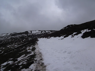
Up via the Nab. Around about the second zig after the stile we started hitting snow drifts left from the snow earlier in the week.


This is the first time I had been on Kinder Scout covered in snow. several times on the walk we sank up to our knees in drifts. We scrambled to the top of ringing roger, stopped for a quick break, and then set out on the edge towards the top of Grindsbrook. The views (as usual) were stunning.

Quite a hard slog with the snow drifts to negotiate. Erica's feet were soaking.

From Grindsbrook , along to Crowden Tower, Woolpacks and then back down via Jacobs Ladder.
Despite the snow there were plenty of folk out  - including one group with a dog carrying a rucksack.

Stopped for a nice pot of tea, at the station cafe before setting of home.

Around 10 miles OS1 Dark Peak


Big Moor 24th October 2024

 I have done the Curbar Edge / Baslow Edge /  Birchen Edge so many times it was good to try a different route in the area. This first time o...