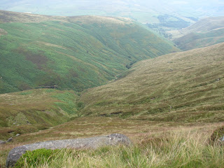
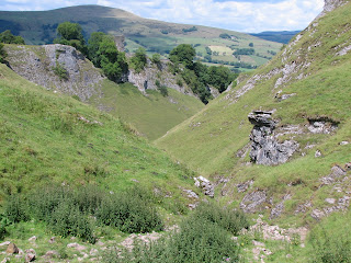
Lots of walking stuff

Tuesday, 30 August 2011

Cromford 28th August

I wanted to find a walk which isn’t to far to drive to the start, with some uphill and good views. This definitely fits the bill. It only took me 20 minutes to get to Cromford Wharf car park. So just a short 4 mile walk. Over the A6 to Cromford Market place. Around the mill pond and then about 100 yards on the main road. Left onto
Bedhouse Lane
just past the Bell Inn and then follow the footpath up towards Black Rock.  The walk I was following (AA 1000 walks in the UK) suggested I took the right path at a fork in the footpath, but this just seemed to take me to the front drive of a house in front of the woods. I took the left hand fork and this took me through the woods and out at the High Peak trail below Black Rocks. I just followed the high peak trail back down to high peak junction and then back to the car park via the canal. I can see a couple of ways of adding a few more miles to this to make it a more substantial walk. The nice thing about this is that I could do this on a summer evening after work.


4 miles OL 24 White Peak

Curbar Edge Froggat Edge Aug 26th 2011


Another walk on Curbar Edge (with Richard F)

Starting from Curbar Gap again.  Baslow edge , Wellington’s Monument, White Edge, Grouse inn, Froggat edge , Curbar edge and back to Curbar gap.

Despite getting soaked for the second half of the walk this was quite an easy walk as there was no climbing involved. Great views all the way around.

I think this would be a great place to bring young kids for a picnic. You don’t have to walk too far from the car park and there are loads of places to sit and enjoy the view.

My supposedly waterproof jacket didn’t keep me dry in the downpour so it was useful to know that I need to do something about this before winter.

8 miles OL24 White Peak

Sunday, 21 August 2011

20th August 2011 Curbar Edge

First time I have done this walk.

Parked up at lay by just below Curbar Gap car park.

Plan A was to follow a walk from a book which was to drop down to the Derwent valley at Curbar. This changed to Plan B after chatting to a couple who were just setting off on a walk.

So Plan B was a walk along Baslow edge for about 3/4 mile and then take the footpath which drops down into Baslow. Over the bridge near the church and then pick up the footpath by the Derwent.

It took me a while finding the correct footpath near Bubnell farm.From there I followed the path down to Calver, over the road and then along the path past Stocking farm. Just after the wier the path crosses a road (New Bridge I think). The path drops down to the river but after a few hundred yards took me to a road (Sheffield / Froggat Road) - I backtracked (half way back to Calver in the end) but couldn't figure out which the correct footpath was to take along the valley to Grindleford.


So Plan C - I decided to pick up the footpath from Froggat up to the Edge. After a tidy climb I reached the point on the edge where Curbar Edge becomes Froggat Edge. Stopped for lunch here. I can't think of anywhere better to have lunch than sat on a gritstone edge in Derbyshire on a warm dry day - brilliant !!


Back along Curbar Edge enjoying the fantastic views across the Derwent Valley to the gap and back down to the car.

I'll definitely do this walk again - figure out the footpath to Grindleford and then do the entire length of Froggat Edge and Curbar Edge


OL 24 White Peak. About 7 miles (includes missed footpaths !!)

Tuesday, 16 August 2011

Saturday 13th August Shipley Park

Going away for most of the weekend, so decided on a short local walk before we set off.

Me and our ageing border colly Tammy.

Out of Smalley Village to Old Pit Lane and then across the fields to Shipley Country Park. It is quite a flat walk but there is some elavation as you approach the park - nice views across the park , and unfortunately the opencast workings to the right.


 Into the park, past the visitors centre and then back
out along Bell Lane. Before reacing Smalley Dam ,
 cut across the fields back into Smalley.


Only about four miles , but a nice start to the weekend. It was good to not have to drive anywhere and no map needed.  Tammy enjoyed it although she was limping a bit towards the end.

Tuesday, 9 August 2011

Sunday 7th August - Kinder Scout again

I was planning a solo walk along Curbar / Froggat edge, but got an invite up to Edale from a friend (Trevor). So with various family members that made a group of six.

We went up via the Nab , and Ringing Roger, and then did the edge path round to Grindsbrook, Crowden Tower, Woolpacks,and down via Jacobs ladder.

Compared to last week this was like a walk in the park.

Jake and Rowan didn't bring any waterproofs and sure enough were soaked when we had a downpour!! However, after the rain cleared and the wind picked up for a while they soon dried off. We stopped for lunch just below Crowden Tower, and found a piece of metal which could be a bit of aircraft wreck. I took a pic and put it back where we found it.

There were three guys with a dog who tried to climb down the gully near Crowden Tower - the poor dog didn't seem that keen. I have never tried that - it looks pretty steep. Sure enough they returned five minutes later looking for another way down.

Another great walk on Kinder, and a nice change for me doing it in a group.


Piece of aircraft wreck ?

About 8 miles . OS1 - Dark Peak map

Saturday, 6 August 2011

Sunday 31st July 2011 - Kinder Scout The Edge

For some reason I decided it would be a good idea to walk the entire rim of Kinder Scout. From Edale this is approx imately 20 miles. Bloody hell !! - My ageing frame is used to 6-9 mile walks so this one was quite a challenge for me.

Starting point Edale Car park. Up to the edge via the Nab. I did the short scramble to the top of Ringing Roger and then started anti-clockwise.  Great views from here across to Mam Tor and the Great Ridge. Keeping to the path I reached the Easternmost point of the walk Crookstone Knoll with a nice view of Ladybower Resevoir, and Derwent Edge.

From here turn west and start along the Northern Edge. This was the bit I was looking forward to as I have never done this section of Kinder before. Fairly soon after leaving Crookstone I lost the path. There was a path leading up to Mad Woman's Stones , but not the direction I needed. I kept heading in the right direction, but it was hard going in the heather. Eventually after about 20 minutes I found the path. The Northen edge has some faboulous views across to the North - Bleaklow , Featherbed Moss , Ashop Moor - see pics below. Seal Stones next , then Fairbrook Naize. At Fairbrook Naize I had to walk in towards the plareau along the edge of the gulley until it became shallow enough to scramble across to the other side. The views North East and West from here are magnificent. After five hours since the start I stopped for some lunch on Ashop Moor  Edge. At this point I was probably half way around. It seemed like slow progress but the views are so stunning I had to keep stopping to take pictures.

Keeping west the path finally meets the Pennine Way and then turns South East towards Kinder Downfall. More brilliant views down to Hayfield and Kinder Resevoir. Stopped at Kinder Downfall for some fruit. What is it about the sheep around there - they are not like normal sheep - cheeky buggers come up close and try to nick your food. - one was trying to nuzzle it way into my rucksack !!.

My legs and back were starting to complain by now , so the last couple of sections were a bit more endurance than a nice yomp along the edge. So along the western edge to the trig point at Kinder Low - turn East towards Pym chair and the Woolpacks, and then along to the top of Grindsbrook and the last leg back to Ringing Roger, and back down the same way via the Nab.

Now my aches and pains have subsided the walk is now a pleasant memory and an achievment, but if I am honest I would say (given my fitness levels) it was a few miles too far for enjoyment.

The whole thing took me 10 hours.


Fairbrook Naize

Northern Edge


One of the many wierd rock formations on the Ashop Moor edge

19 / 20 miles OS1 - Dark Peak map.

Friday, 5 August 2011

23rd July 2011 Castleton - Ridge - Mam Tor - Cave Dale

Met with friend Richard at Castleton car park.

From there up Hollowford Road and across the fields to the top of Lose Hill.  Right the way along the ridge to Mam Tor. Fairly busy on the ridge and a fair breeze blowing. Dropped just below the ridge near Hollins Cross for some lunch. Even though it is busy at weekends you get stunning views across Hope valley  on one side and Edale and Kinder Scout on the other. To the north west is Win Hill and Derwent Edge

From the top of Mam Tor descended down to Mam Nick , past Windy Knoll . From there we crossed the Road and took the footpath past Rowter farm. This took us to the Limestone Way leading back down into Castleton via Cave Dale.

An enjoyable walk on a warm sunny day.


About 8 miles. OS1 Dark Peak map

9th July 2011 Derwent Edge

I thought I would put in my last few walks to get things started.
Parked at Fairholmes Car Park at the bottom of Derwent resevoir. We (me and son Jake) started around mid morning.
We walked along the Western edge of Ladybower up to the A57. Short stretch on the road across the bridge and then off the road at Ashopton, through the woods up to Whinstone Lee. It is a short sharp climb but fairly quickly you are on the edge with a fantastic panoramic view of Ladybower , Win Hill, Mam Tor, Kinder and Bleaklow. We walked along to the Wheel Stones and had some lunch. Just before Back Tor we dropped down off the ridge and headed for Derwent resevoir. At one point Jake was convinced we were lost as we couldn't see the Resevoir. From that sid it is quite well hidden and you don't see it until you are right on top of it.
We walked back along the edge of derwent res, and just before we got to the side of the dam there was a photograper with two drop dead gorgeous models doing a photo shoot !! There was a couple of cyclist who quite unashamedly had stopped, got of thier bikes and were enjoying the scenery .

A great day in glorious sunshine.


approx 12miles. OL1 - Dark Peak map.

Thursday, 4 August 2011

First Post

Given that I have spent my working life in front of computers, it is a bit surprising that it has taken me this long to have a go at writing a blog. The plan is to keep a record of my walks, and hopefully attach a few pics to each post.
I have always liked walking but it is only the last couple of years I have got into it properly. I live near Derby and am no further than an hours drive to various parts of the peak district. I love it up near Castleton and Edale, but there are also some great walks in the Derbyshire Dales.
Having started relatively late I feel that I am in catch up mode and would love to get some Wainright walks under my belt - we sayed in the Lakes a couple of years ago and did some walking on Catbells and Maiden Moor - so there is a lot to go at there.
Then there is Wales - we did the tourist route up Snowdon a few years ago , but I am now drawn (I don't know why because I am scared of heights) to have a go at Crib Goch.....maybe I should try some of the lake District Ridges first.

Big Moor 24th October 2024

 I have done the Curbar Edge / Baslow Edge /  Birchen Edge so many times it was good to try a different route in the area. This first time o...