Lots of walking stuff

Saturday, 25 July 2015

Wednesday 22nd July 2015 Rosthwaite Fell- Glamara – Allen Crags

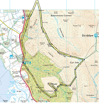
Day off to the Lakes for another fine day of fell walking. As the second segment of this walk involved no paths (Rosthwaite Fell summit ridge / plateau) I loaded some waypoints into my Garmin , and these proved really useful.


Up at 4 AM , followed by a reasonable trip up to Cumbria. I parked at Seatoller (NT car park). From the car park turn left and walk along the road for about three hundred yards. Just after Mountain View cottages there is a footpath sign on the right. Following this across to the far corner of the field there is a footbridge across a stream (looking at the map, this is a tributary of the River Derwent). From there the path climbs the side of the Fell for a short distance before veering right at a shallower angle. After a few hundred yards the path then turns towards the left and starts to climb steeply up the fell. The OS map clearly shows a path which brings you out at Tarn at Leaves, but I soon lost the path (as did a fellow walker), so I aimed at what seemed to be a decent line to a small dip in the first visible ridge. After a 
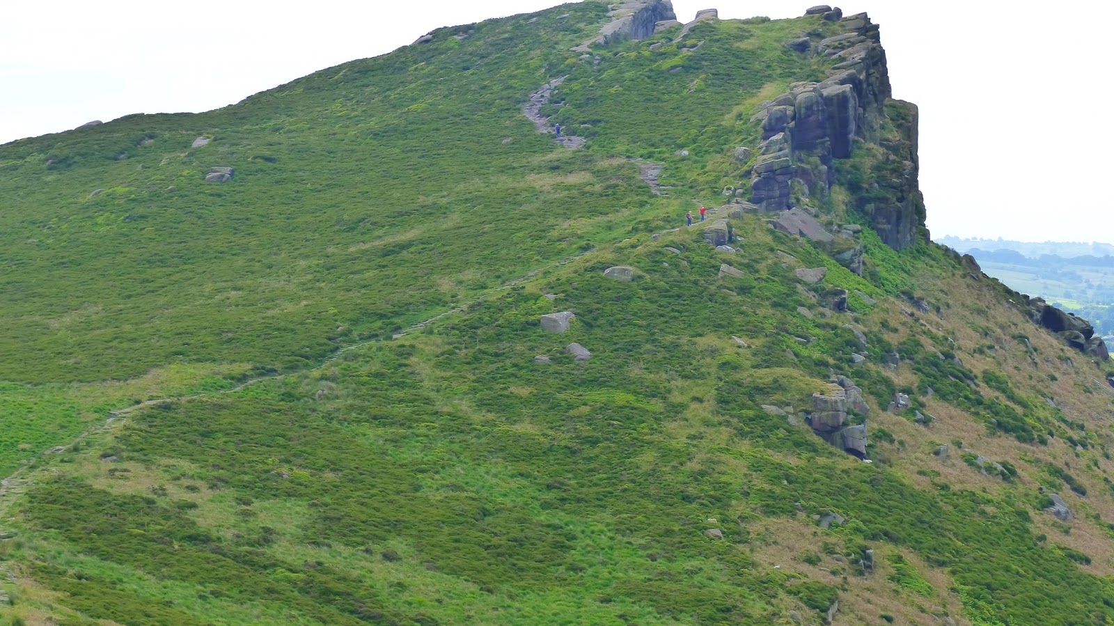
tough , steep climb (and as usual many ‘false’ summits), I arrived at the ridge , but this brought me out well north of Bessyboot. 
First high point on ridge before Bessyboot

Tarn at Leaves

Bessyboot Summit


After sorting out my co-ordinates I headed for the summit of Bessyboot with Tarn at Leaves at the foot. From here the fun started ….. To the South West on the skyline I could see Glamara summit, but actually I couldn’t – this turned out to be Combe Head. I set off from the summit of Bessyboot to skirt left of Rosthwaite Cam , and at that point as I was a lot lower on the plateau , and I had no line of sight for my target I set my Garmin to lead me to the edge of the great hollow. This next section included negotiating my way over rocky outcrops, around small tarns and swampy / boggy sections. Next Target was Combe Door, which involved similar terrain. I could now see the summit of Glamara again.
Yet another obstacle

Coombe Door (I think?)

Langdale Pikes


 I figured the best way would be to get on the West ridge to take me to the summit. However, what looked like one solid mass of rocks turned out to be several. So up one and this just brought me to a dip with the start of the summit ridge across a boggy hollow. Up a boulder strewn gully to the summit……NO….this turned out to be the summit of Combe Head with the ‘real Glamara’ due South across yet another boggy hollow. Finally, after a mild scramble I arrived at the top of Glamara. It seems fitting that Wainwright #100 should not be a straightforward one !!

Glamara Summit

Glamara Summit Shelter


During the crossing of Rosthwaite Fell I had glorious views all around of Great Gable, the Langdale Pikes and Derwent Water in the distance.

I have to say , by this point I was really tired after all the ups and downs , and wet patches, so I was less than impressed when the rain and mist blew in reducing visibility down to about 30/ 40 feet. I certainly couldn’t see the ‘clear’ path leading to Allen Crags. I decided  that I needed to get the grid ref of Allen Crags from the map and tap that into my Garmin. Once again, this great little device kept me  on route. The mist quickly cleared and I could see the path about a couple of hundred yards away. All I needed to do was scramble down from the rock I was on down to the path. However, I soon came to an abrupt halt as my way was blocked by a 30 foot cliff. I had to backtrack and veer left to get a gradual way around to meet the path below. From there it was a clear trek to Allen Crags crossing some picturesque tarns on the way. Finally, I arrived at Allen Crags summit with some wonderful clear paths showing down to the Esk Hause area. Due to my tiredness at this point , there was no chance I was going to tackle Esk Pike today (it would have been an extra 2 miles to the walk ) My journey back was the excellent path along Ruddy Gill / Grains Gill, back down to Seathwaite, with the last mile along the road to Seatoller. This is a spectacular but comfortable descent with waterfalls on view and the mass of Glamara to the right.

Allen Crags Summit

Rosthwaite Fell from the car park

One of many tarns near the path to Allen Crags

A tough mountain day, but very rewarding. The walk shown above is around 10 miles but I am claiming 12 miles , with all the ups and downs and sidetracking on Rosthwaite Fell !!  By the time I had got back to the car I had been out 9 hours.


OS OL4 (NW Lakes) and OL6 (SW Lakes) About twelve miles

Friday 10th July 2015. Roaches / Luds Church

Same walk I have done a few times. With Richard this time on a hot, clear day.

Same route as previously..:-


  • Park Near Upper Hulme just below Hen Cloud
  • Climb up to the start of the Roaches Ridge
  • Walk the ridge to Roaches end
  • Follow the ridge that then drops down into the woods via a concessionary path.
  • Luds Church
  • Back through the woods to Roaches end.
  • Back along the ridge to the car.
Hen Cloud

Who is this man ?

Jodrell Bank at maximum zoom from the Roaches

View down to the plain from rocks on the edge

After the walk we drove down to the visitor centre at Tittesworth Reservoir for a pot of tea and a giant scone. 

Lud's Church


I must have done this walk about 4 times now , and it never fails to deliver.

About 6.5 miles OS OL 24 White Peak

Tuesday, 30 June 2015

Kinder Scout 19th June 2015


First proper trip of the year to Kinder Scout. The February visit didn’t really count as I didn’t get to the top.


My route up was the standard Nab- Ringing Roger, as usual soaking up the fantastic views on the way up. I had decided the evening before to have a little excursion onto the Eastern section  of the plateau. I had put the grid reference of a WW2 plane wreck and Mad Woman’s stones into my Garmin. I set off across the plateau supposedly heading for the wreck of a Wellington bomber. When I reached the target reference there was nothing there – just lots of boggy peat, with the trig point on Edale Moor not far away. I headed for the trig point for some photos and a drink of water. My Garmin was complaining that the batteries were running down , so I decided that I should just head back to the edge where navigation is simple. I tried retracing my steps but as per other excursions onto the plateau it is very easy to become disoriented as it is almost impossible to head in a straight line. One of my legs dissapered into the soggy peat up to my knee on this section. Fairly soon Madwoman’s Stone’s came into view , so I decided I would visit them and this would then give me a clear bearing to get back to the edge path.

Trig Point on Edale Moor

Lots of squidgy peat bog

Madwomans Stones


I have to say , on reflection that ‘bog trotting’ across this sort of terrain is not my favourite type of walking !!

From Madwoman’s Stones I picked up a faint path which took me to the edge path east of Ringing Roger.

Druids Stone


This next section of the walk was my favorite – a high level tramp along the edge with a good path and brilliant views.

The great ridge from the edge of Kinder


Eventually I reached the top of Grindsbrook Clough which marked my descent down. I haven’t gone down this way for years. The first few hundred feet are a scramble, but as long as you take your time easy enough. After that section the path is fairly well defined as it winds its way down the valley with Grindsbrook to the right.

On the way down


Soon I was back at the car park. Another great day out on Kinder Scout.

OS OL1 Dark Peak. About 8 miles

Monday, 1 June 2015

Saturday 30th May. Grike – Lank Rigg

My first venture to the far west of Lakeland. There was a little voice in my head saying that these are only small fells and it will be an easy and possibly unspectacular walk. Shame on me !! As usual, this beautiful, small corner of the Cumbria 
Top of Grike

Lank Rigg from Grike
came up with the goods. A great days walking, with varied views and plenty of challenges.


My first challenge was finding the starting place which I can now say is the minor road just outside Ennerdale Bridge signposted Gosforth, with the parking spot near the forestry commission footpath. I then couldn’t find the correct footpath which should take me through the forest to the slopes of Grike. It turns out the signpost was non existent – different from the walk outline I had downloaded. With some playing around with my Garmin I located the path and set off.

Ennerdale Water from the top of Crag Fell

Pillar 


The path taook me up the slopes of Grike to the summit and then across a boggy depression of the joining ridge to Crag fell with stunning views across ennerdale water and the Pillar range.

The downloaded instructions from the Walk the Lakes site were brilliant from then on. I could see the trig point on the summit of Lank Rigg on the skyline and it looked a long way off !!. The path took me to the depression between Crag Fell and Whoap (pronounced Warp) with is a parallel ridge separating Crag Fell and Lank Rigg.
Lank Rigg - from the bottom !


Whoap Beck Valley

Top of Lank Rigg

View South from the top of Lank Rigg


Climbing up through the cleared forestry land I was soon at the top of Whoap, looking at the climb to Lank Rigg. This was a steady slog (last bit steep) to the top. Short drink and photo break, and then I set off on the return leg which took me don to the dip between Lank Rigg and Whoap . Left turn there and down the  beautiful (wet and boggy in places) Whoap Beck valley. This also include a couple of fords which left me with soaking feet. Eventually the path met the road , maybe 0.5 – 1 mile above my parking place.

Another three Wainwrights – A brilliant days walking.


OS OL 4.  
9 miles

Saturday 23rd May Robin Hoods Bay – Ravenscar

Family weekend away at Robin Hoods Bay. Did this walk with Anne along part of the Cleveland Way.

Just after here the path drops down to Boggle Hole

I love this woman

Headland at Robin Hoods Bay

Highest zoom - can;t see any seals !


From Robin Hoods Bay old town the cliff path is an easy (well relatively !!)  stepped climb to the top. The well defined path then meanders its way along the cliff top, dropping down to the beach at Boggle Hole and the climbing back again. This drop and climb was then repeated near Stoupe Bank. From there it is steady climb across lovely countryside to Ravenscar, with the track taking us through the ruins of the Alum Mines. Unfortunately for Anne , all th ups and downs put strain on her recovering sprained ankle , so by the time we got to Ravenscar she was using the walking poles and was in some pain. We stopped for a late lunch at the tea rooms and because they were so inept (forgot our order) , we had sat for qite some time which meant Anne’s ankle had a good rest.
Robin Hoods Bay From Ravenscar

We retraced our steps back to the dip in the cliff path at Stoup Bank , and from there strolled back along the beach all the way back to Robin Hoods bay which was perfect for a sore ankle.

A brilliant and varied walk, with outstanding views all the way.


About 8 miles OS OL27 North York Moors 

Monday, 4 May 2015

1st May 2015 Ullock Pike Ridge

Next chapter in my Wainwright adventure.

A clear, war day  with a little breeze. Perfect.

This was a medium sized walk but as usual I had the aches and sores for a couple of days after !! Also, this was the first trip to the lakes with my new panasonic bridge camera.

After an early start and a good drive I arrived at the Mirehouses car park on the east side of Bassenthwaite Lake, This is also the starting point to walk up to the Osprey viewing point on the side of Dodd.


Between the two buildings I crossed the footbridge an took a left onto a waymarked footpath through the woods. I kept following the yellow waymarks until they stopped and the path continued through Rabbit Warren before meeting the path coming up from Ravenstone Hotel. Turn right here and the path climbs steeply up to a gate and then onto the open fellside. After a decent climb the path meets the ridge line. Turn right here and Ullock Pike summit can be clearly seen in the distance.

Ullock Pike

Bassenthwaite Lake


Top of Ullock Pike

Long Side Edge from Ullock Pike

From here navigation was straightforward. Ullock Pike - Longside Edge, Carl Side. At Carl Side tarn I surveyed the possibility of climbing Skiddaw and Skidaw Little Man. I reckoned this would add around 4 miles to the day including a steep up and down of Skiddaw. I decided against that. Skiddaw Little Man would have to be bagged on another day.

Skiddaw Little Man

Dodd from Longside Edge
Newlands Valley


The path down Carl Side to Long Doors col was a straightforward zig zag but typically Lake District rough, bumpy and rocky in places. 

Top of Longside Edge with Skiddaw in the background
Bassenthwaite from top of Dodd

Dodd Summit


From Long Doors I took the excellent track through Dodd Wood to the summit of Dodd. Although this was the lowest summit of the day it offered the best views along Bassenthwaite,  Newlands valley, and Derwent Water.

I followed the forest road back to the car park to finish yet another excellent day in Lakeland.

OS OL 4 NW Lakes. Around 6.5 miles

19th April Millers Dale , Tideswell Dale

Excellent walk with Richard. It makes a nice change to do a walk with little climbing involved.


We started opposite the church in the centre of Litton.Heading east along the main road, we took the first road right and then after a couple of hundred yards found the clearly marked footpath which took us over some gently undulating hills to the top edge of Cressbrook Dale. From there we took the path down to the valley floor and then followed the path to the Weir at Cressbrook Mill,


Beautiful scenery all the way from there along the splendidly named Water-Cum_Jolly-Dale, Millers Dale and Tideswell Dale for the final bit of the walk which was a short stroll along the road back into Litton.

OS OL24 White Peak. Around 5,5 miles

Shining Cliff Wood - Cromford Canal 30/07/2025

  Great walk. About 7 miles.