Lots of walking stuff

Sunday, 27 September 2015

Blencathra Sept 27th 2015

Probably the last chance I would get for a trip to the Lakes this year, as the builders are coming back next week and we will be busy with the new kitchen. Excellent weather for walking - slightly cloudy with some wonderful autumn sunshine poking through the clouds.


I had planned to do some of the Ulldale fells North of Skiddaw but at the last minute (driving on the A66) I glanced up at Blencathra and decided to change the plans.
Summit Ridge


Summit

Scales Tarn


The route and navigation was simple. Park at Blencathra Centre just outside Threkeld, It is virtually a case of stepping out of the car onto the Fell. Up Blease Fell on an excellent path and onto the summit ridge.  Views from the top were outstanding and spectacular.

Causey Pike in the distance

Halls Fell

Looking down from the summit

A brave soul on Sharp Edge


From the summit I had a stroll along the ridge to get some pics of Sharp Edge and Scales Tarn.

Return by the same route.

Harvey Superwalker - Northern Lakes. 5 Miles

Monday, 7 September 2015

5th September 2015 Fairfield Horseshoe

A brilliant September day in Cumbria. Bright , clear and warm.

Leg 1

Leg 2

Leg 3

Leg 4

Final Section


Great Rigg

Dr Fulcher with his new camera

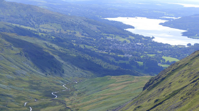
Windemere in the distance


I did this walk a couple of year ago ....in the mist so I didn't get to see much. It was fantastic to do it in clear weather and with someone else (Richard). Because I haven't done many walks recently I was a bit 'out of shape' so found it hard going. However, we got round in one piece !!. Clockwise from the car park in Ambleside on the Grasmere road.

St Sunday Crag from the top of Fairfield

Top of Fairfield


I had considered taking in Stone Arthur as a little detour but by the time we were close to the sunmit of Great Rigg an extra 2 mile detour including 1000 ft down and then back up again did not appear to attractive.

Taking a rest before the descent

Heron Pike and Great Rigg

So - no new Wainwrights bagged this time , but my 'second time round list' is now into double figures.


Superb day out - about 10.5 miles. OS OL5 and OL7

16th August Crich

Been busy with the builders around every day , so it was good to get away for a few hours to do this walk. Not much driving involved and the same route as normal - Anti Clockwise from the small car park near Whatstandwell.


About 6.5 miles OS OL 24 White Peak

Saturday, 25 July 2015

Wednesday 22nd July 2015 Rosthwaite Fell- Glamara – Allen Crags

Day off to the Lakes for another fine day of fell walking. As the second segment of this walk involved no paths (Rosthwaite Fell summit ridge / plateau) I loaded some waypoints into my Garmin , and these proved really useful.


Up at 4 AM , followed by a reasonable trip up to Cumbria. I parked at Seatoller (NT car park). From the car park turn left and walk along the road for about three hundred yards. Just after Mountain View cottages there is a footpath sign on the right. Following this across to the far corner of the field there is a footbridge across a stream (looking at the map, this is a tributary of the River Derwent). From there the path climbs the side of the Fell for a short distance before veering right at a shallower angle. After a few hundred yards the path then turns towards the left and starts to climb steeply up the fell. The OS map clearly shows a path which brings you out at Tarn at Leaves, but I soon lost the path (as did a fellow walker), so I aimed at what seemed to be a decent line to a small dip in the first visible ridge. After a tough , steep climb (and as usual many ‘false’ summits), I arrived at the ridge , but this brought me out well north of Bessyboot. 
First high point on ridge before Bessyboot

Tarn at Leaves

Bessyboot Summit


After sorting out my co-ordinates I headed for the summit of Bessyboot with Tarn at Leaves at the foot. From here the fun started ….. To the South West on the skyline I could see Glamara summit, but actually I couldn’t – this turned out to be Combe Head. I set off from the summit of Bessyboot to skirt left of Rosthwaite Cam , and at that point as I was a lot lower on the plateau , and I had no line of sight for my target I set my Garmin to lead me to the edge of the great hollow. This next section included negotiating my way over rocky outcrops, around small tarns and swampy / boggy sections. Next Target was Combe Door, which involved similar terrain. I could now see the summit of Glamara again.
Yet another obstacle

Coombe Door (I think?)

Langdale Pikes


 I figured the best way would be to get on the West ridge to take me to the summit. However, what looked like one solid mass of rocks turned out to be several. So up one and this just brought me to a dip with the start of the summit ridge across a boggy hollow. Up a boulder strewn gully to the summit……NO….this turned out to be the summit of Combe Head with the ‘real Glamara’ due South across yet another boggy hollow. Finally, after a mild scramble I arrived at the top of Glamara. It seems fitting that Wainwright #100 should not be a straightforward one !!

Glamara Summit

Glamara Summit Shelter


During the crossing of Rosthwaite Fell I had glorious views all around of Great Gable, the Langdale Pikes and Derwent Water in the distance.

I have to say , by this point I was really tired after all the ups and downs , and wet patches, so I was less than impressed when the rain and mist blew in reducing visibility down to about 30/ 40 feet. I certainly couldn’t see the ‘clear’ path leading to Allen Crags. I decided  that I needed to get the grid ref of Allen Crags from the map and tap that into my Garmin. Once again, this great little device kept me  on route. The mist quickly cleared and I could see the path about a couple of hundred yards away. All I needed to do was scramble down from the rock I was on down to the path. However, I soon came to an abrupt halt as my way was blocked by a 30 foot cliff. I had to backtrack and veer left to get a gradual way around to meet the path below. From there it was a clear trek to Allen Crags crossing some picturesque tarns on the way. Finally, I arrived at Allen Crags summit with some wonderful clear paths showing down to the Esk Hause area. Due to my tiredness at this point , there was no chance I was going to tackle Esk Pike today (it would have been an extra 2 miles to the walk ) My journey back was the excellent path along Ruddy Gill / Grains Gill, back down to Seathwaite, with the last mile along the road to Seatoller. This is a spectacular but comfortable descent with waterfalls on view and the mass of Glamara to the right.

Allen Crags Summit

Rosthwaite Fell from the car park

One of many tarns near the path to Allen Crags

A tough mountain day, but very rewarding. The walk shown above is around 10 miles but I am claiming 12 miles , with all the ups and downs and sidetracking on Rosthwaite Fell !!  By the time I had got back to the car I had been out 9 hours.


OS OL4 (NW Lakes) and OL6 (SW Lakes) About twelve miles

Friday 10th July 2015. Roaches / Luds Church

Same walk I have done a few times. With Richard this time on a hot, clear day.

Same route as previously..:-


  • Park Near Upper Hulme just below Hen Cloud
  • Climb up to the start of the Roaches Ridge
  • Walk the ridge to Roaches end
  • Follow the ridge that then drops down into the woods via a concessionary path.
  • Luds Church
  • Back through the woods to Roaches end.
  • Back along the ridge to the car.
Hen Cloud

Who is this man ?

Jodrell Bank at maximum zoom from the Roaches

View down to the plain from rocks on the edge

After the walk we drove down to the visitor centre at Tittesworth Reservoir for a pot of tea and a giant scone. 

Lud's Church


I must have done this walk about 4 times now , and it never fails to deliver.

About 6.5 miles OS OL 24 White Peak

Tuesday, 30 June 2015

Kinder Scout 19th June 2015


First proper trip of the year to Kinder Scout. The February visit didn’t really count as I didn’t get to the top.


My route up was the standard Nab- Ringing Roger, as usual soaking up the fantastic views on the way up. I had decided the evening before to have a little excursion onto the Eastern section  of the plateau. I had put the grid reference of a WW2 plane wreck and Mad Woman’s stones into my Garmin. I set off across the plateau supposedly heading for the wreck of a Wellington bomber. When I reached the target reference there was nothing there – just lots of boggy peat, with the trig point on Edale Moor not far away. I headed for the trig point for some photos and a drink of water. My Garmin was complaining that the batteries were running down , so I decided that I should just head back to the edge where navigation is simple. I tried retracing my steps but as per other excursions onto the plateau it is very easy to become disoriented as it is almost impossible to head in a straight line. One of my legs dissapered into the soggy peat up to my knee on this section. Fairly soon Madwoman’s Stone’s came into view , so I decided I would visit them and this would then give me a clear bearing to get back to the edge path.

Trig Point on Edale Moor

Lots of squidgy peat bog

Madwomans Stones


I have to say , on reflection that ‘bog trotting’ across this sort of terrain is not my favourite type of walking !!

From Madwoman’s Stones I picked up a faint path which took me to the edge path east of Ringing Roger.

Druids Stone


This next section of the walk was my favorite – a high level tramp along the edge with a good path and brilliant views.

The great ridge from the edge of Kinder


Eventually I reached the top of Grindsbrook Clough which marked my descent down. I haven’t gone down this way for years. The first few hundred feet are a scramble, but as long as you take your time easy enough. After that section the path is fairly well defined as it winds its way down the valley with Grindsbrook to the right.

On the way down


Soon I was back at the car park. Another great day out on Kinder Scout.

OS OL1 Dark Peak. About 8 miles

Big Moor 24th October 2024

 I have done the Curbar Edge / Baslow Edge /  Birchen Edge so many times it was good to try a different route in the area. This first time o...