Lots of walking stuff

Monday, 10 September 2012

Lynmouth- Watersmeet September 7th 2012


As near a perfect walk as you can get. Rivers , woods, waterfalls, a climb a coastal path and a fantastic tea room half way around.


The weather was sunny with a light breeze – great conditions for walking. We (Anne and myself) headed out from the centre of Lynmouth and followed the footpath along the river Lyn. We had to cross the river a few times and at one point climbed away from it. I won’t ramble on about how beautiful the scenery was ….I’ll let the pictures do that. Eventually we reached Watersmeet which is an old fishing lodge where the Hoar Oak meets the Lyn. Before getting a cuppa we did a half mile detour to see a waterfall. The fishing lodge is now owned by the National Trust and is a visitor centre and tea room. We sat at a picnic table on the lawn soaking up the fantastic views and sharing our cakes with the chaffinches (well the crumbs from our cakes  !!).


At the back of the lodge is a footpath which climbs steeply up the side of the gorge. After several zig zags this emerges at a clearing at the top of the gorge which grand views all around. From there we walked along Tilly Ridge with is a gentle climb across to Countisbury Church which is just across the A39. From the church grounds there is a short path that leads to the coastal path. Again – I’ll let the pictures do the talking. Apart from going slightly wrong for about 50 yards where we ended up walking on the road this leg was a straightforward walk all the way back to Lynmouth.


About 7 miles 

Wednesday, 5 September 2012

Stanage Edge 4th September 2012


I am a lucky man – summer in September to coincide with two weeks off work.


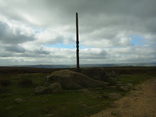
I parked at the layby opposite Higger Tor on the Ringinlow Road. From there I followed the footpath to Stanege Edge. Rather than get straight up onto the edge I followed it on the slope below for about half a mile before climbing up. Great views on a lovely warm clear sunny day. I walked along the path as far as the turn off to Stanage Pole and then I turned right an headed that way. At Stanage Pole there are great views across to the edge of Sheffield and Redmires Resevoirs. Apparently, Stannage Pole marks the Southernmost point of Sout Yorkshire.
Looking across to High Neb near the end of the edge


I then backtracked the way I came right to the end of Stanage edge near the trig point, passing lots of walkers and climbers on the way.
 From there I took the path down to Upper Burbage bridge where I stopped for a drink and something to eat. Taking the Sheffield country walk path along the edge of Burbage valley with great view across to Higger Tor and Carl Wark iron age  fort. Higger Tor looked like quite a prospect from this angle. I then took the right hand turn which drops down into the valley at  the edge of the woods. Out of curiosity I took a reading on my Garmin so that I could work out what the climb was up to the top of Higger Tor. The path then led up to the Col between Higger Tor and the fort and then from there a good path becoming increasingly steep at it reached the summit of Higger Tor (400 feet of ascent from the valley bottom ). Stopped there for a rest to enjoy the views and take some pics and then down the other side to the car.

Stanage Pole
 

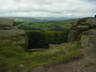
Looking down from Stanage edge


The final climb up to Higger Tor
 

According to Tracklogs 290m of ascent (951 ft)….didn’t feel like that.


About 7 miles  951ft of ascent OS OL1 Dark Peak area


Big Moor 24th October 2024

 I have done the Curbar Edge / Baslow Edge /  Birchen Edge so many times it was good to try a different route in the area. This first time o...