Lots of walking stuff

Wednesday, 30 May 2012

Scafell Pike – Great End 26th May 2012

First time on the big one !
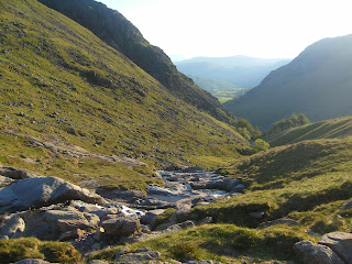
On the way up the side of Seathwaite Fell looking back


I set of from the YH at Honister Hause early (5 AM) and got a good parking spot at Seathwaite. After yesterdays adventure in the heat, I thought an early start in the cooler morning would be a good idea (plus plenty of water !!).
Styhead Tarn at 7AM - beautiful


Along the path to Stockley bridge and then up and around  the flank of Seathwaite Fell towards Styhead Tarn.  I reached the Tarn for 7.00AM  and stopped for breakfast and a rest.  Just after setting off I had a navigation malfunction (just after the stretcher box), which lost me about 30 mins. Eventually I found the start of the corridor route, and set off….an interesting and varied path with great views all the way.  There were a couple of ‘bad steps’ to negotiate where the path stopped and a scramble down was required. I think this direction would be easier than going the other way. Eventually I got to the final turn from the path to the summit (lingmell col I think) which was well marked with a series of summits, and also a stream of people coming down (and I thought I had set off early). This last climb was a slog of several hundred feet over loose rocky  ground.

hmmm


The summit was like Clapham junction !! – Charity groups, 3 peakers, normal folk like myself……hmmm. Very windy but with clear views all around….the Irish Sea was clear and blue on the horizon. I did consider Sca Fell at this point but decided that with a five mile return and yesterday’s aches and pains, that I would leave this for another day.
Looking down from the corridor route


From the summit I headed off towards Broad Crag and Ill Crag as the plan was to head down via Esk Hause. There isn’t much of a path and due to the uneven rocky ground going is slow. At Esk Hause I took the short detour across the plateau of Great End to the summit, with great views down to Borrowdale and Derwent Water.

On top of England


Back down to Esk Hause where I dropped down to pick up the path down to Seathwaite and another descent with spectacular views down the valley.

From Great end Summit loooking down to Borrowdale


Eventually I reached Stockley Bridge and back along the starting path to the car.

Esk Hause

A fantastic way to spen a sunny Saturday morning

About 11-12 miles

OS OL 6 English Lakes South western

Haystacks – High Stile Ridge – Buttermere 25th May 2012

Day 1 of a two day stay in the Lakes. I arrived at the Honister Pass Youth Hostel around 10 AM , sorted out my kit and then I was away at about 10.20.


Weather – Hot and Sunny with a light breeze. Followed the path at the back of the Slate mine car park up to Haystacks. Not too much of a height gain to get to Haystacks summit as Honister Pass is at 356 m….so a nice easy start to the day. As Wainwright describes this is a beautiful fell. Two mountains tarns at the base of it and a small one at the summit. I sat next to this one and ate my lunch…glorious sunshine , a little breeze, great views…I am on happy bunny !!.  However, the rest of the walk was somewhat more strenuous.
Blackbeck Tarn
Haystacks summit tarn


 If there is a path down from Haystacks to Scarth Gap Pass, I couldn’t see it, so I scrambled down, and faced with the daunting view of the climb up to High Crag – I must admit at that point and in that heat I nearly bottled it – got the map out and looked to see what alternatives I had – maybe a walk down the valley to Ennerdale. I then reminded myself that these opportunities don’t come that often so once I had negotiated the smaller fell of Seat off I set up the zig zag path to the top of High Crag. Once I got going it didn’t seem too bad, but I realised I had made a big mistake with the amount of water I had brought…only a litre in this heat…idiot.
High Crag looks a bit....well high from this angle


Once on High Crag Summit you are rewarded (as usual in the Lakes) with spectacular views all around Buttermere , Robinson, Fleetwith Pike, the Scafell Range, Pillar…brilliant.

Buttermere from the ridge


The walk along the ridge to High Stile and then Red Pike was fantastic. I had made the decision that I would drop down to Buttermere and head back that way rather than return via the route out. The descent from Red Pike to Bleaberry Tarn was steep (and scary) The red clay / shale was very loose, and I was glad I had one walking pole with me. I ended up on my backside several times, but got down safely. Bleaberry Tarn is a beautiful and peaceful spot…a good place to catch my breath and enjoy the view.


The zig zag path down the valley side eventually came out at the West end of Buttermere. By the time I got there all my water was gone. I didn’t realise how bad real thirst is (cracked lips, dry throat etc). I won’t make this mistake again. The highlight of the walk around Buttermere was a red Squirrel. I got pretty close to it , but the pic I took didn’t come out. From Gatescarth I took the long slog up the Honister pass to the YH. I didn’t have anything left in the legs to do it via Fleetwith Pike.
Bleaberry Tarn


Apart from the thirst, a spectacular walk.


Around 13-14 miles

OS OL 4 Lakes North Western

Saturday, 19 May 2012

Derwent Edge 13th May

With Richard F.

Met Richard at Fairholmes car park, and started with a nice easy leg of the walk along the Western Shore of Ladybower. Short walk along the A57 over to the other side of ladybower.


Then up the footpath to Ashopton and Whinstone Lee Tor. It is a short sharp climb and then you are rewarded with fantastic views across Ladybower, Win Hill and Kinder scout in the distance. We followed the well defined path to the Wheel Stones and then onwards as far as Back Tor. After a short break we headed back the way we came before taking the path downwards towards the resevoirs.....so slightly different from the planned route above. We just followed what seemed to be the most obvious footpths (ignoring the map) and eventually this brought us down to the Eastern shores of Ladybower about half a mile down from Fairholmes. Walking past Derwent Dam we noticed it was full with water spilling over the top....so much for a hose pipe ban!! Nice easy walk back along the road and a cup of tea at Fairholmes.

Pics to follow

About 10 Miles OL 1 Dark Peak 

Saturday, 5 May 2012

2rd May – Scar Crags - Sail

We had planned a day at the seaside today. As the weather forecast was so good I got up at 6.00 for an early walk before we set off for St Bees.


Up the miners track as far as Outerside. Then take the path (not on the map) up to the ridge between Causey Pike and Scar Crags. Along the ridge to Scar Crags, which has a surprising flat summit plateau. It is mornings like this which remind me why I do this. It was calm , sunny, I was the only person on the fell, and there was a spectacular panoramic views all around. Towards Derwent Water and the Skiddaw range there was a low mist with the peaks still visible. Hopefully some of the pictures do this justice.


Ridge approach to Scar Crags


Sail from summit of Scar Crags

Misty Mountains


From there follow the path down to Sail pass, and then up the zig zag path to the summit of Sail. As soon as I reached that summit I was confronted with the mass of Crag Hill…tantalising close. However, looking at the steepness of the climb, with possibly some scrambling, I decided to decline, as I had promised Anne I would be back at the cottage for 10.00 AM. So just a picture of Crag Hill today…I’ll be back another day to do that one.
Crag Hill - so near.....

Back down to Sail Pass and then follow the track (bit scary in places) down to the miners track and then back down to the cottage.

 8 Wainwrights for the week……only another 197 to go !!

 About 7 miles  -  English Lakes OL4

2nd May 2012 – Rigg Beck, Whinlatter Forest, Cat Bells

Rigg Beck


We decided to walk up the road from the cottage to where the path up Rigg Beck begins. Great walk up the valley as far as the path really starts to climb up the hillside. Spectacular views up and down the valley and to the sides the flanks of Causey Pike and Ard Crags on either side. We were out for a two and a half hours and then returned to the cottage for some lunch.
On te path along Rigg Beck with Ard cRags in the background

looking to the head of the pass

Looking back down to Newlands


Whinlatter Forest


After lunch we drove the few miles to the Whinlatter forest visitors centre and did one of the waymarked walks around the forest. Apart from great views (as usual) the highlight was spotting a couple of roe deer grazing in the forest.


Cat Bells


Derwent water from the top of Cat Bells
After the forest we drove back to the cottage and as it was still such a glorious day (around 5pm) I took a walk up Cat Bells. Down the valley across Gyll Bank and up the side of the fell. After the short scramble to the summit, I walked along the ridge to Gate Hause and then dropped down to the path which runs along the side of the fell and then back across the valley. Nice thing about this walk was no maps, compass, bags etc…just a camera.


About 7 miles in total -  English Lakes OL4

Wednesday, 2 May 2012

1st May 2012 Waterfalls , Mines and Wainwrights

1st May – Waterfalls , Mines and Wainwrights


Moss Force


View down the Newlands valley from Newlands Hause
Cool , overcast day...we decided to get in the car and see if we could find some waterfalls. From the cottage we drove up the Newlands valley up to Newlands Hause, and parked up. As usual in the Lake District there were spectacular views down the valley from here. We walked up the path to Moss Force waterfall and took some pics. From there we drove onto Buttermere and then up the Honnister Pass to the Slate Mine.
Moss Force


Slate Mine Tour


The tour of the mine was great – the guide was Cynthia who is the mother of Mark Wier , a local businessman who had   rescued the closed mine by buying it, renovating it and turned it into a working mine and tourist attraction. Tragically Mark had died last year in a helicopter crash, but Cynthia delivered the tour with great passion and emotion. Predictably I was the only person to smack my helmet on the roof of a tunnel a I was walking through.
The family dogs accompanied us down the mine – a black retriever/ lab, and a golden retriever…lovely dogs. Made me dog broody....still missing Tammy!


 The views down the valley from the mine entrance were stunning. From there I could clearly see the dip of Littledale from Hindscarth to Robinson that I had walked a few months earlier.

Galen Force

From the mine we headed towards Stonethwaite where we parked up and walked down the valley to Galen Force rapids and waterfalls. Everywhere we go we are rewarded with fantastic views and scenery…this was no disappointment. The only problem is that I am running out of adjectives….I need to take up poetry …it would help if I could write poems!!
Galen Force

Knott Rigg – Ard Crags


Crag Hill Range from Knott Rigg
We drove back up the Honnister Pass through Buttermere and parked up again at Newlands Hause. I got out and Anne drove on back to the cottage. It was about 4 PM so I reckoned that I could walk back over the ridge in a couple of hours. Fantastic walk up the slope to Knott Rigg and then along the ridge to Ard Crag. To the right is Robinson, and to the left is the Crag Hill range.  Very windy at times , but managed not to get blown off.  I used walking poles for the first time and found them very useful (I have used a singe pole previously). From the summit of Ard Crag I descended down to the Beck Rigg bend in the road where the beck passes under the road (next to a Grand Designs type house on the corner). Half a mile up the road to the cottage ....and food. Great end to a great day.

Along the ridge from Knott Rigg

Great linear walk….you always need someone (like my lovely wife) to help with these,...or catch a bus at the end.

Newlands Valley from the top of Knott Rigg

About 6 miles in total -  English Lakes OL4

Big Moor 24th October 2024

 I have done the Curbar Edge / Baslow Edge /  Birchen Edge so many times it was good to try a different route in the area. This first time o...