Lots of walking stuff

Friday, 10 May 2013

Grisedale Pike 6th May 2013

First trip of the year to the Lakes. I had decided at short notice to do a day trip based on the favourable weather forecast, so up at 4, and out on the road for 4.45. The plan was to walk up Grisedale Pike, across the ridge to Hopegill Head , and then Grasmoor and Crag Hill via Coledale Hause.  Well......50% success.


On the way up to Grisedale Pike

Half way up


Grisdale Pike summit in the clouds


I parked just outside Braithwaite on the Whinlatter road, where the old mine road starts. There was a set of steps from the car park straight onto the fell. Navigation was so easy  - I didn't need my map until I got to the top. The tops of the higher peaks were swathed in clouds despite the sunny weather lower down.

 The climb was steady with plenty of stop for rests, and picture taking. As I left the grassy track for the more rocky on I started heading into the mist and eventually reached the summit about two hours after I left the car park. I stopped for a break there and to be honest didn't fancy navigating across to Hopegill Head in the mist (knowing that the massive drop of  Hobcarton Crag would be close to the right hand side of the path). However , a fellow walker emerged out of the mist from that direction and assured me the path was well defined and navigation easy. Good.....I hate turning back.

So off I set into the mist and after about 30 minutes I had reached Hopegill Head. such a shame that there was no view today. I headed off away from the edge along the path to Sand Hill, The path disappeared for a while , but I managed to spot it again after a while. Just I was heading down to Coledale Hause the mist completely lifted , even off the top of the imposing Crag Hill. However, it quickly settled in again on the high ground, so that was the decision made for me - I didn't fancy Crag Hill and Grasmoor in the mist, so I headed off back down Coledale Valley into the glorious sunshine. This second half of the walk was definitely more enjoyable with splendid views all around.


The way back down - Grisdale Pike to the left


Despite the mist , this was a glorious way to spend a bank holiday, and I was really glad that I hadn't rolled over at 4AM and gone back to sleep....which had crossed my mind. Just two Wainwrights today, so Crag Hill will have to wait for another day. This was the second time I had been within touching distance of Crag Hill. I'll be back......

About 10 miles OS OL4

Wednesday, 1 May 2013

Crich Sunday 28th April

The plan was to park up just off the A6 next to Cromford canal, just past Whatstandwell railway station, and then do a circular walk through shining cliff woods and then back along the canal. I crossed the bridge across the Derwent.


River Derwent from the bridge over the A6
 
I crossed the A6 and headed towards the woods but pretty soon it became obvious that the path wasn't public right of way and there was a pack of guard dogs waiting to savage me. I went along the track about half  a mile towards a caravan site and then decided to abort......I hate turning back , but this was one occasion it seemed right. I went back to where I was parked and did the Crich Chase , Crich Stand , Whatstandwell, Cromford Canal walk in reverse to the many times I had done it before.

Really enjoyed this. Funnly enough took a couple of wrong turns doing the walk in the opposite direction. The other thing that surprised me was how battered I felt after this walk. It is only 7 - 8 miles with a bit of climbing .....I guess it was down to not having done too much walking this year.


Crossing the track on the Crich Tram centre


Crich stand


About 6.5 Miles OS OL 24

Sunday, 10 March 2013

Kinder Scout 3rd March 2013

This was one the few decent weekends of weather we have had this year, so it was good to get out on a decent walk.

I met Richard at edale car park around 10.00 and set off into Edale village. Although this is a walk I have done several times it is always enjoyable with great viws from the southern edge of the plateau.


Dr Fulcher on the summit of Ringing Roger
The route was Edale --The Nab -- Ringing Roger -- Nether Tor -- Harshorn -- Top of Grindsbrook Clough-- Crowden  Tower-- Wool Packs -- Pym's Chair-- Jacob's Ladder -- Upper Booth --Edale.

A beautiful,  clear , crisp day with a gentle breeze - perfect for walking. As we had both not done much walking this year our creaking joints were starting to complain by the time we got to Upper Booth, and the last (relatively flat leg) to Edale felt like a bit of a slog.

Cup of tea and flap jack at the station cafe before setting off home...............perfect.

What a poser


The Wool Packs


About 9 miles OS OL1 Dark Peak

Saturday, 24 November 2012

Curbar Edge 12th November

Haven't posted for a while due to working away a lot and a few weekends where I have just gone out for a bike ride on my new mean machine. This was the last proper walk I did on a rare day off from work.


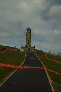
Wellington's Monument

Where's Mum ?


Weather was clear crisp and fresh. I parked at Curbar gap , and then did the circuit along the edges :-
Baslow edge to  Wellington's monument - White Edge - Froggat Edge - Curbar Edge.


Curbar Edge


A terrific walk which helped to lift my winter blues.

About 7 miles OS24 White Peak

Saturday, 20 October 2012

Whatstandwell - Crich 14th October

Whatstandwell - Crich   -  14th October


Nice to get out on a decent walk, with not too much driving to get to the start point. I found a little car park just past Whatstandwell - right turn off the A6 just as the A6 takes a sharp left. So the difference to other times is that virtually the whole of the canal section is at the start of the walk rather than the end. Other than that , same as last time :-

Whatstandwell - Cromford Canal - Ambergate - Crich Chase - Crich - Crich Stand - Cromford Canal - Whatstandwell.


OS OL24 White Peak about 6.5 miles

Friday, 19 October 2012

Bits and Pieces

Bits and Pieces


Been busy at work since hols and haven't managed any big walks. However, I have done a few local walks from home and these have been variations on :-

Smalley - Smalley Dam - West Hallam - Smalley  - Woodside - Smalley

Smalley - Old Pit Lane - Shipley Park - Visitors Centre - Bell Lane - Smalley

Smalley - Bell Lane -Shipley Park - Osbornes Pond - Shipley Hill - Mapperley Resevoir - Bell Lane - Smalley


Between 4 - 7 miles

Monday, 10 September 2012

Lynmouth- Watersmeet September 7th 2012


As near a perfect walk as you can get. Rivers , woods, waterfalls, a climb a coastal path and a fantastic tea room half way around.


The weather was sunny with a light breeze – great conditions for walking. We (Anne and myself) headed out from the centre of Lynmouth and followed the footpath along the river Lyn. We had to cross the river a few times and at one point climbed away from it. I won’t ramble on about how beautiful the scenery was ….I’ll let the pictures do that. Eventually we reached Watersmeet which is an old fishing lodge where the Hoar Oak meets the Lyn. Before getting a cuppa we did a half mile detour to see a waterfall. The fishing lodge is now owned by the National Trust and is a visitor centre and tea room. We sat at a picnic table on the lawn soaking up the fantastic views and sharing our cakes with the chaffinches (well the crumbs from our cakes  !!).


At the back of the lodge is a footpath which climbs steeply up the side of the gorge. After several zig zags this emerges at a clearing at the top of the gorge which grand views all around. From there we walked along Tilly Ridge with is a gentle climb across to Countisbury Church which is just across the A39. From the church grounds there is a short path that leads to the coastal path. Again – I’ll let the pictures do the talking. Apart from going slightly wrong for about 50 yards where we ended up walking on the road this leg was a straightforward walk all the way back to Lynmouth.


About 7 miles 

Shining Cliff Wood - Cromford Canal 30/07/2025

  Great walk. About 7 miles.