Lots of walking stuff

Sunday, 22 April 2012

22nd April Monsal Head Brushfield


A wet Sunday morning but I needed to get out for a walk. There was a walk out of Trail mag which took in Wardlow , Litton , and Monsal Head which I thought I would try. However, by the time I got to Monsall Head car park I opted for something shorter as it was p****** it down.


Litton Tunnel
I haven’t been to Monsal Head since some of the tunnels were opened last year (May) , so I followed the Monsal trail and walked through Cressbrook Tunnel and Litton Tunnel. My White Peak   map doesn’t show these tunnels so I wasn’t exactly sure where I was on the Monsal trail at times. After the Litton tunnel there is a footbridge over the path with a footpath to the left signposted Priestcliffe Lees Nature reserve. After a short climb up the bank of the hill my superb navigation skills kicked in again and I took the wrong turn. I ended up walking along the top ridge of the hill with fantastic views across Millers Dale …but not the path I wanted to be on. My trusty Garmin got me out of jail again. I was walking along High Field (no footpath on my map). Inadvertently I have discovered a great spot for a picnic in summer – great views and off the beaten track, and unless someone is dumb enough to take the wrong turn along there it would be nice and quiet !!

its that dodgy bloke again


After a U turn I picked up the corect path that leads down to Brushfield and then back along the top of the valley back to the viaduct.


Excellent medium walk for a Sunday morning.


About 5 -6 miles (including the detour)  OS24 White Peak


Saturday, 21 April 2012

7th April Kinder Scout

Another walk with Erica and Damien.

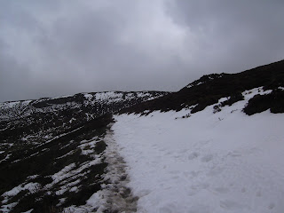
Up via the Nab. Around about the second zig after the stile we started hitting snow drifts left from the snow earlier in the week.


This is the first time I had been on Kinder Scout covered in snow. several times on the walk we sank up to our knees in drifts. We scrambled to the top of ringing roger, stopped for a quick break, and then set out on the edge towards the top of Grindsbrook. The views (as usual) were stunning.

Quite a hard slog with the snow drifts to negotiate. Erica's feet were soaking.

From Grindsbrook , along to Crowden Tower, Woolpacks and then back down via Jacobs Ladder.
Despite the snow there were plenty of folk out  - including one group with a dog carrying a rucksack.

Stopped for a nice pot of tea, at the station cafe before setting of home.

Around 10 miles OS1 Dark Peak


Monday, 19 March 2012

Rushup Edge- Brown Knoll - Kinder Scout 17th March 2012

I haven’t done a walk around Edale since last August , and as the weather looked good for walking today seemed like a good day.


I printed out a route map from my new Tracklogs digital map of the Dark Peak. First time I had used this. Although it is a bit pricey it is a fine piece of software.


From the car park I walked up to Rushup Edge via Hardenclough farm. This initial climb soon warmed me up and off came the top two layers.


Just before I got to the road I passed a group of Duke of Edinborough Silver award youngsters. They were on their last day walking across to Hope to catch a train. It was a bit like day of the zombies – they looked like they had been put through the mangle !


Vale of edale from Rushup edge
Across the road and up onto the edge. Weather perfect for a walk. Cool and clear (few clouds gathering over Kinder), with hardly any wind.  I have walked along Rushup edge before but not this route across to Brown Knoll. It wasn’t clear where the path to Brown Knoll leaves the main path, but a fellow walker pointed out the air shaft on Cowbourne Tunnel as a clear landmark. I picked up the path which after a while soon became vague and  non existent in places. I now know  the meaning of bog trotting. On three occasions I ended up to my knees in wet soggy peat !. Quite pleased that my gaiters protected the top of my boots and my feet remained dry. At one point I am sure I must have helped three fell runners who were about 100 yards behind me when my bottom half disappeared in the peat. I looked back once I was clear and saw them making a wide detour of where I went in !


Edge of Kinder looking down Grindsbrook Clough
 Although it is quite a level walk I found it hard work due to the lack of a clear path and the wet soggy ground.  After the trig point on Brown Knoll (pretty unremarkable place), I found my way to the fence with the clearly defined path which leads to a  T- junction with Jacob’s ladder.


From there a more familiar climb up to Edale Rocks for a bite to  eat.


Dodgy Bloke on the edge of Kinder !
Along the edge via the Woolpacks, and across to the  top of Grindsbrook Clough.  Back down into Edale via Grindsbrook Knoll.


Another excellent walk around the Vale of Edale.  This felt more like a fifteen mile walk rather than the ten covered.


10 Miles OS1 dark Peak

Sunday, 4 March 2012

Castleton Ridge 3rd March 2012

With Erica and Damien.

Great to get back on the hills after several weekends behind a computer screen.

This was the same route I have done a couple of times before.

Visitors car park - Hollowford road - Lose Hill - Ridge - Mam Tor - Limestone way - Cave Dale.


Mam Tor about to disappear in a cloud

Erica and Damien trying out some hill walking with a view to the three peaks challenge in June. (26 miles three mountains ....I am not sure)  They were both wearing trainers , so plenty of slips and a few falls. The climb up to Lose hill was hard work after a few weeks of inactivity, and the storm cloud were gathering. Luckily the weather blew over and as you can see from some of the pics , by the time we reached Mam Tor the sun was out. 
The final descent down Cave dale into Castleton was a bit tricky...specially wearing trainers.

Cup of tea and a toasted sandwich in Castleton . Great way to spend a saturday morning


About 6.5 miles OS1 Dark Peak

Thursday, 19 January 2012

Bleaklow 15th January 2012


Short winter walk with Richard F

We met up at the Snake pass summit. Temperature about -5. I got quite cold getting ready as I had driven there in t shirt and sandals...maybe next time I get kitted up before getting in the car !!

We set off on the Pennine Way path and gradually after 20 minutes or so I could feel the end of my fingers. there was only a gentle breeze but it was bloody  freezing.

 We crossed Hern Clough, and then took a left turn off the path with the aim of getting to Higher Shelf Stones and the Superfortress wreck. I had put the grid reference into my Garmin Etrex but like a muppet had my device set to geo caching WGS84 datum rather than OS grid. After a while it was fairly obvious that we were below Higher Shelf Stones and my device was way off !!.   There was a whole load of fell runners coming down towards us ...we found out later they were running from Crowden to Edale - 20 miles across the most amazing terrain..effectively the first leg of the Pennine Way in reverse.

We were only a few hundred yards off, and on our way up to the ridge saw a mountain hare - fantastic to see this type of wildlife ..I have only seen one of these before on Kinder.

The B-29 crash site is amazing and sobering  - there is a memorial there and large pieces of wreckage over several hundred yards. This has been there for over 60 years. I don't feel that this was a 'disaster' tourist exercise - I was in awe at the scale of the disaster - a huge plane (the largest around in 1948) and the scale and height of Bleaklow, and the fact that 13 young men lost thier lives - due to go home to America shortly after this flight.

Short walk to the trig point where there was a whole load of folk and a tent !...  check off point for the fell runners plus a group of walkers on a break.

From here there is a fantastic view over Glossop, Manchester and Kinder Scout. Cup of tea and a rest.

Drop down and across to the Pennine Way path dodging the increasing number of fell runners.

As Richard said 'A different walk' ....very enjoyable , and now I have my GPS with the correct settings I'll be more confident about walking on Bleaklow which is such a contrast to Kinder Scout.


Around 5 miles Dark Peak OS1

Monday, 2 January 2012

Chatsworth 30th December 2011

A nice walk to end the year with. Parked at Carlton Lees car park (only £2). Crossed the road into the estate and then a short walk to the hump back bridge over the Derwent. Over the bridge and then follow the lane which skirts the eastern edge of the estate up towards the ridge. That was a fair gradient which warmed me  up. Take the stile to the left onto a well defined path across a field which leads to a ladder stile over a wall and into the estate again.
Across the ridge and then into Stand Woods. Follow well  defined paths past Swiss Lake on the left and Emperor Lake on the right. Take a sharp left around the hunting tower and follow the path past an old ruined viaduct and then take the right hairpin wihich winds down through the woods to the house. Quick stop for a cup of coffee and then follow the river back to the car park. Got fairly close to a group of Deer and took a few snaps.
I enjoyed this more than expected and would definitely do it again.


OL 24 White Peak about 6 miles

Shipley Park 27th December 2011

Usual circuit of Shipley Park. Up Old Pit lane and across the fields into the Park. Visitors Centre and then back to Smalley via Bell Lane. I took Tammy as far as the visitors centre. Anne came and picked her up from there. The last time she came on the full walk she was limping for a day aftre that.

Wore my new soft shell jacket over a fleece and it certainly works and keeps me warm. Towards the end of the walk the hat was off and the ventilation zips on the side were fully open.

A great way to clear the Christmas cobwebs.

About 4 miles

Shining Cliff Wood - Cromford Canal 30/07/2025

  Great walk. About 7 miles.